Planning Landscape Photography with Photo Ephemeris March 9, 2023 – Posted in: Photography
By Stephen Trainor, Founder of Photo Ephemeris
Growing up in the north east of England, my bedroom faced west looking toward the countryside of Northumberland from the outskirts of town. At 55°N, the sweep of sunset across the year was unmissable.

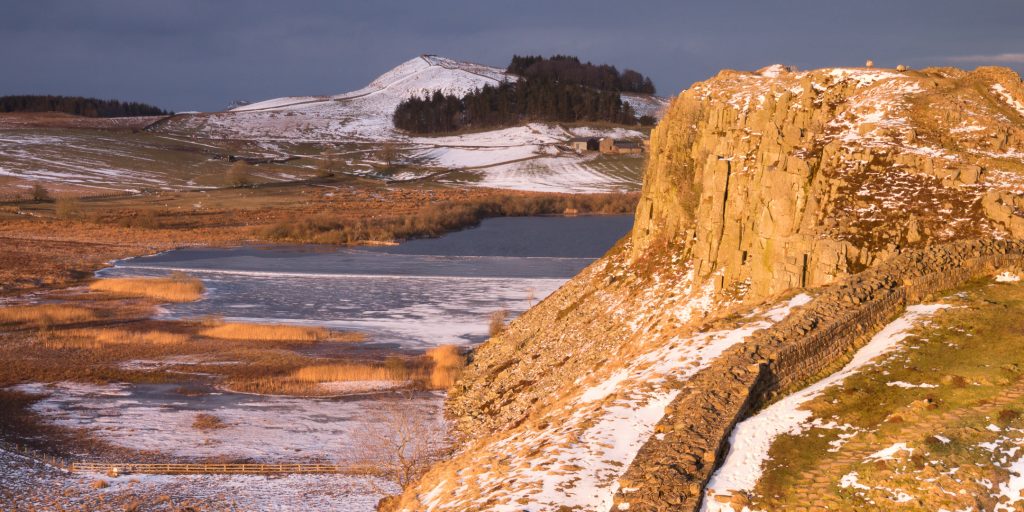
The view along Hadrian’s Wall at Crag Lough, near Milecastle 39.
In June, the sun dropped below the horizon a few minutes before 10pm to the northwest, with twilight never quite fading to darkness overnight. At the December solstice, shortly after school finished for the holidays, the sun was down by 3:40pm, setting full southwest.
Despite a childhood spent watching the movement of the sun across the year, it wasn’t until 2008 that the connection to landscape photography planning was forged in my mind. A workshop with photographer and Rocky Nook author Glenn Randall in Rocky Mountain National Park drew together threads of scientific, astronomical, and photographic knowledge to build an understanding of how successful photographs can be conceived, planned and executed.
At that time, sunrise and sunset information tended to be presented numerically – tables of figures that could be checked for dates and places of interest. Armed at our workshop with a topographic map, ruler, protractor, pencil and calculator, Glenn had his students mapping out the direction of light, elevation angles of mountains, and shooting distances and angles. Coupled with insights into how light behaves as the sun moves across the horizon and rises into the sky, we were able to identify the most promising shot locations and times for the weekend.
All this sparked the original idea for The Photographer’s Ephemeris – map-centric planning software for outdoor photographers, a digital equivalent of the techniques Glenn had taught the class.

Why ‘Ephemeris’? An ephemeris traditionally is a table of figures plotting the path of an astronomical object, such as the Sun or the Moon, through the sky. The Photographer’s Ephemeris does the same, but presents the information visually in relation to the landscape, as a photographer might expect. The name is also a nod to “Ephemeris” a popular Sun and Moon app for PocketPC (remember those?) made back in the day by Jonathan Sachs, co-founder of Lotus 1-2-3.
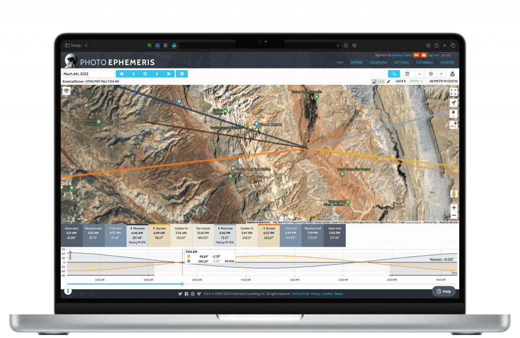
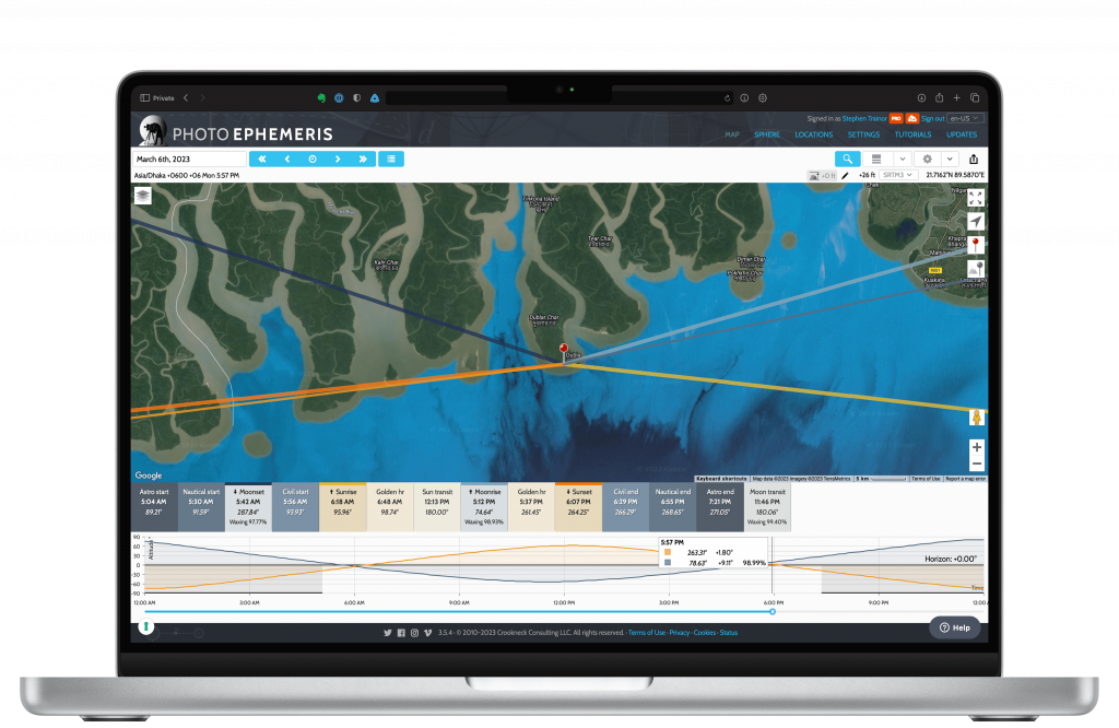
Today the software is available as a browser-based web app for use on desktop and laptops and as a mobile app (currently available for iOS).

The original map-based presentation remains the core of the software, but it has been expanded with many additional features and capabilities, including:
- Night photography: the galactic center and band of the Milky Way, stars, meteor showers
- 3D terrain: visualize the position of the Sun, Moon, or Galactic Center relative to a 3D model of the landscape – particularly helpful in mountainous areas
- Visual search: specify what part of the sky you would like the Sun, Moon or Galactic Center to appear and the software will find the corresponding dates and times for you
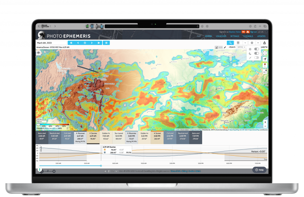
- Skyfire: view forecasts of when colorful sunrise and sunsets may occur based on analysis of the Sun position, cloud density, relative humidity and visibility weather data.

In photography, a little preparation and planning goes a long way. Reading books such as a Glenn’s “The Art, Science, and Craft of Great Landscape Photography” and “Dusk to Dawn: A Guide to Landscape Photography at Night” can build your understanding of the concepts and techniques required to achieve great results. Spending time with tools such as The Photographer’s Ephemeris will help consolidate your understanding of how light will behave across the year at your shooting locations.
And most importantly, be sure to get out there, apply your knowledge and planning, and realise your own photographic vision.
Stephen Trainor – Founder of Photo Ephemeris
